Issaquah to Snoqualmie Bike Ride – 16 Miles
Full trip:
Google map (route ends 3 miles early because no official trail from the Falls overlook)
Start at PCC in Issaquah:

Issaquah-Preston Trail
The Issaquah-Preston Trail provides a 7-mile link between the "locks to lakes corridor" and the Mountains to Sound Greenway. The trail starts at a junction with the East Lake Sammamish Trail in Issaquah and continues east along Interstate-90 toward Preston.
The Issaquah-Preston Trail provides a 7-mile link between the "locks to lakes corridor" and the Mountains to Sound Greenway. The trail starts at a junction with the East Lake Sammamish Trail in Issaquah and continues east along Interstate-90 toward Preston. The trail is paved to Issaquah Highlands where it connects that community with downtown Issaquah and other regional trails.
From Issaquah Highlands, the trail continues east as a soft-surface route above Issaquah Creek and I-90 into High Point. From High Point eastward, the route follows High Point Way, a winding rural road, to Preston. In Preston the trail connects with the Preston-Snoqualmie Trail. Portions of the trail are managed by the Washington State Department of Transportation.
The new section between High Point and SE High Point Way is hard-packed gravel, which parallels I-90 for a stretch. The trail intersects the southern terminus of the E. Lake Sammamish Trail at I-90. The best place to start is at Pickering Farm in Issaquah, which has a paved city path leading to the actual start of the Issaquah-Preston Trail (there is no decent parking at the start of the Issaquah-Preston Trail under the I-90 bridge). Pictures
At the 6.7 mile mark:

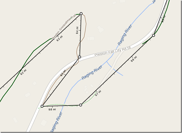
At the 9.3 mark, cross the river on the road:
“On the Fall City side there are seven switchbacks which descend to the valley floor. Then, back up the other side. Walk this aerobic part.”

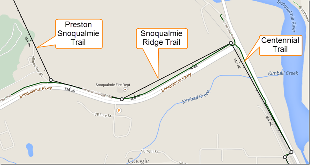
At the 13.5 mark, enter the Snoqualmie Ridge Trail, then the Centennial Trail at 14.1:
Preston-Snoqualmie Trail
The Preston-Snoqualmie Trail is a 7-mile-long paved regional trail through steep terrain within the Mountains to Sound Greenway. The PST retraces a historic railroad route with gentle grades ideal for walking, running, and bicycling.
The Preston-Snoqualmie Trail is a 7-mile-long paved regional trail through steep terrain within the Mountains to Sound Greenway. The PST runs east from High Point Way near the Interstate-90 Preston Park-and-Ride to just west of Snoqualmie Falls. The PST retraces a historic railroad route with gentle grades ideal for walking, running, and bicycling. The demolition of a historical railroad trestle in Preston provides one exception where the route detours into the Raging River Valley before climbing again to the north side of Snoqualmie Ridge. The trail continues along the ridge through secluded woodlands with exceptional views of the Snoqualmie River Valley and ends with a viewpoint overlooking Snoqualmie Falls. The trail is linked to Snoqualmie Ridge via City of Snoqualmie soft-surface community trails.
Then surface streets to the Snoqualmie Valley Trail:
-
Archives
- May 2015 (1)
- April 2015 (3)
- March 2015 (1)
- February 2015 (1)
- January 2015 (1)
- December 2014 (1)
- November 2014 (3)
- October 2014 (3)
- September 2014 (1)
- June 2014 (3)
- December 2013 (1)
- October 2013 (1)
-
Categories
-
RSS
Entries RSS
Comments RSS


